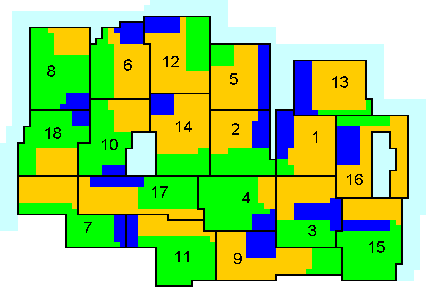
Diagramatic Map of Northern Ireland Parliamentary Constituencies showing religion as reported in the 2001 census table KS07a.
With the image sized at 574 x 873 pixels, each pixel represents approximately 5.3 people.
|
 Catholic Catholic
|
 Other Christian Other Christian
|
 Other / None Other / None
|
|
| 1 | Belfast East | 10 | Mid Ulster |
| 2 | Belfast North | 11 | Newry and Armagh |
| 3 | Belfast South | 12 | North Antrim |
| 4 | Belfast West | 13 | North Down |
| 5 | East Antrim | 14 | South Antrim |
| 6 | East Londonderry | 15 | South Down |
| 7 | Fermanagh and South Tyrone | 16 | Strangford |
| 8 | Foyle | 17 | Upper Bann |
| 9 | Lagan Valley | 18 | West Tyrone |